Currently
N/A°F
in De Luz, California, USA

N/A°F / N/A°F
N/A
N/A
Wednesday, April 30, 2025 8:16 AM PDT
De Luz
Currently
Forecast
Past Weather
Climate
Last 36 Hours
Weather News
Features
F.A.Q.
Contact Us
Use °C/Metric
 RSS Feed
 Follow UsWeatherCurrents
Local Roundup
Mobile Access
On Your Site
Follow UsWeatherCurrents
Local Roundup
Mobile Access
On Your Site
Esperanza Fire Smoke and Ash Fills Inland Valleys Thursday
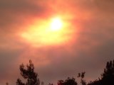
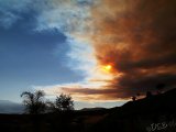
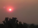
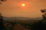
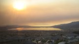
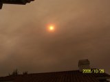
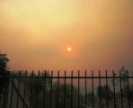
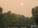
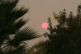
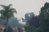
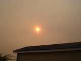
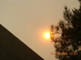
Posted October 26, 2006, 2:36 PM.Poor air quality resulting from a fire south of Cabazon, named the Esparanza Fire, was affecting most of the inland valleys in western Riverside County Thursday afternoon. Mandatory evacuations were ordered in Cabazon as the fire, which began this morning at 1:12am, grew to 4,500 acres in size and threatened homes in the area by 1 pm. Over three hundred firefighters as well as several helicopters and air tankers were actively fighting the wildfire. Highway 79 between Hemet and Beaumont was closed, and SR 243 between Banning and Idyllwild was closed as well. There were reports of smoke and ash as far south as Temecula as Santa Ana winds blew from the northeast. The fire was burning along the northern slope of the San Jacinto mountains. Cabazon is east of Riverside and Banning, northeast of Hemet, and west of Palm Springs, in the pass area between Mt. San Gorgonio and Mt. San Jacinto. Hemet

Murrieta
Lake Elsinore
Temecula
|
Other Recent Weather News for De Luz, California
|