Currently
N/A°F
in De Luz, California, USA

N/A°F / N/A°F
N/A
N/A
Wednesday, April 30, 2025 8:09 AM PDT
De Luz
Currently
Forecast
Past Weather
Climate
Last 36 Hours
Weather News
Features
F.A.Q.
Contact Us
Use °C/Metric
 RSS Feed
 Follow UsWeatherCurrents
Local Roundup
Mobile Access
On Your Site
Follow UsWeatherCurrents
Local Roundup
Mobile Access
On Your Site
Storm photos: rain, rivers and flooding (updated)
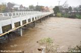
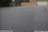
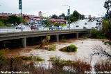
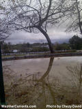
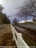
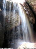
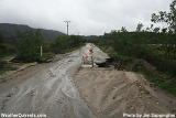
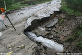
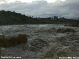
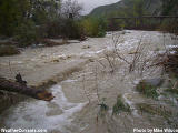
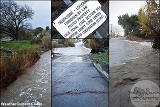
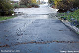
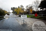
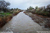
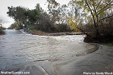
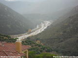
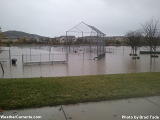
Posted December 28, 2010, 12:05 AM.The following are reader-contributed photos of some effect of a six day storm that featured the heaviest rainfall since WeatherCurrents began ten years ago. Many of the photos are from the final day of the storm, when six to fourteen inches of rain over six days had begun to cause heavy flooding. Throughout Southern California's inland valleys, street flooding was evident, with full storm drains and cresting creeks and rivers. One of the photos shows Murrieta Creek cresting in Old Town Temecula; another couple show the San Jacinto River busily transporting runoff down from the mountains. Photos were contributed by Greg Turbeville, Brad Tade, Tina Engel, Douglas Leany, Sandy Wood, Mike Wilson, John Ward, Jim Sappington, Chezy David, Enya Preston and Pennie Leachman. If you've got a storm-related photo to add, please send it in. Temecula

Temecula Valley Wine Country
Hemet
Murrieta
Fallbrook
French Valley
|
Other Recent Weather News for De Luz, California
|