N/A°F / N/A°F
N/A
N/A
Storm totals: February 27th-28th, 2012
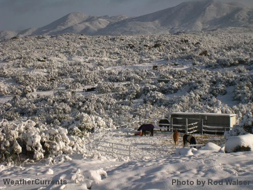
By John C. Toman. Posted March 4, 2012, 2:31 PM.A cold Pacific storm rolled through Southern California last Monday and Tuesday, leaving the most significant rain of the month, some hail, and even snow down below 2,000 feet in some inland locations. The previous February storm, about two weeks ago, had left topsy-turvy rain totals, favoring the central part of Riverside County that often gets the driest results from storms. This storm dropped the most rainfall in more traditional spots like the Temecula Valley Wine Country(1.15"), Temecula (0.82"), De Luz (0.74"), and Fallbrook (0.73"). Also among the leaders were Beaumont (Cherry Valley) (0.79"), and Hemet (0.74"). Both locations had some snowfall Monday evening, with Valle Vista getting a dusting, snow all the way down to the Soboba Indian Reservation above San Jacinto, and 1-4" of snow in Cherry Valley, which was still on the ground Tuesday morning. Pea-sized hail fell Monday afternoon, in the 2pm hour, in Temecula and also in Fallbrook. As the storm cleared Tuesday afternoon, snow was visible two-thirds of the way down North Mountain in the San Jacinto Valley, and most of the way down Agua Tibia south of Temecula. Totals in East San Jacinto were 0.81". To the west, in Ventura County, the storm barely grazed Simi Valley (0.03"). In the Inland Empire region, the smallest totals were in San Bernardino (0.22"), Wildomar (0.29"), Moreno Valley (0.30") and Lake Elsinore (0.31"). Down south, the more coastal City Heights neighborhood of San Diego recorded 0.44". Despite the strong storm, rain totals for the month and season remained well under normal. Temecula's February total of 1.46", for instance, was more than two inches below normal, as was Fallbrook's 1.29", Murrieta's 1.25" and Lake Elsinore's 0.82". Hemet's 1.46", Menifee's 1.36" and Riverside's 0.71" were about half the normal totals for those communities. Thanks to Monty Parrott, Robert Leonard, Rick Leonard, Jim Toman and R.C. Blankenhorn for weather reports during the storm. Here are the rain totals for the WeatherCurrents network and associates:
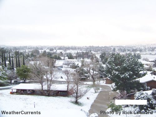
Snow Tuesday morning in Cherry Valley (courtesy of Rick Leonard)
Snow Tuesday in Sage at 3200' (courtesy of Rod Walser) |
Other Recent Weather News for Simi Valley, California
|