Currently
69°F
in Murrieta, California, USA
72°F / 51°F
11 mph S
0.00"
Thursday, May 2, 2024 3:53 PM PDT
Murrieta
Currently
Forecast
Past Weather
Climate
Last 36 Hours
Weather News
Features
F.A.Q.
Contact Us
Use °C/Metric
 RSS Feed
 Follow UsWeatherCurrents
Local Roundup
Mobile Access
On Your Site
Follow UsWeatherCurrents
Local Roundup
Mobile Access
On Your Site
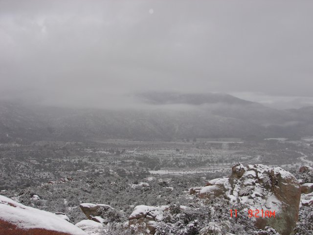
 March Snowfall: March 11-12, 2006
| March 11, 2006, 9:21am: From the Aguanga Ranchos, looking over Highway 79 South towards Vail Lake and Temecula. Aguanga, east of Temecula, ranges in elevation from approximately 2,500 to 3,500 feet above sea level. Photo by Ida Martin. |
 |