
N/A°F / N/A°F
N/A
N/A
Photos From The Eagle Fire: May 2-7, 2004
Last updated 1:34pm May 23rd
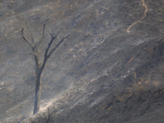
The photos below capture the development of the Eagle Fire on Sunday, May 2nd, 2004 and on Monday, May 3rd, 2004. The Eagle Fire began around 3pm Sunday, according to local reports, south of the Morgan Hill development in the southern Temecula Valley. The fire began and stayed well out of the Temecula city limits, south and east of the Redhawk and Vail Ranch areas, and south of State Route 79, in the Agua Tibia and Palomar Mountain foothills. The fire continues to burning eastward away from the city, towards the Woodchuck campgrounds (which were evacuated Monday afternoon).
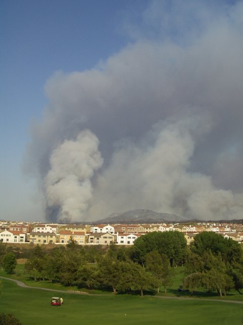
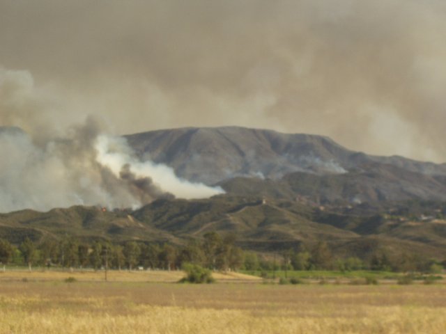
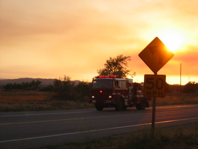
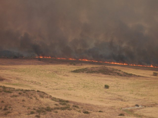
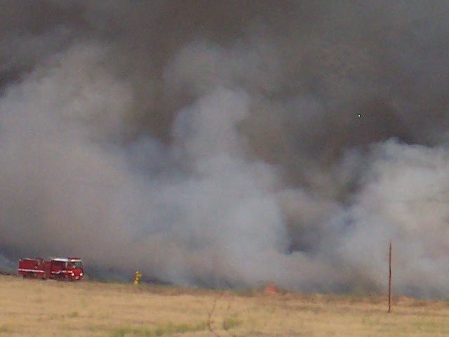
On Monday morning, it was reported by several sources that 750 acres had burned and two homes were destroyed. At that point the fire was 30% contained. But another day of high heat on Monday (Temecula reached 100°F and so did most of the surrounding areas) and easterly then westerly afternoon winds fanned the flames. Late Monday afternoon, the fire had charred an estimated 2,500 acres and had jumped State Route 79 east of Temecula, forcing the closure of the road between Temecula and Aguanga. At sundown the fireline had appeared to separate into two distinct areas, one south of the Morgan Hill area, and the other further east near the Cleveland National Forest boundary, near Vail Lake. Much of the area in between was still smoldering.
On Tuesday morning, it's been reported that the fire has expanded to 4,000 acres. The fire had expanded to 4,800 acres and there were over 1,200 firefighters on hand battling the blaze. The Dorland Mountain Artist Colony, southeast of Temecula, has been reported destroyed. Thirteen structures, including homes and mobile homes, have been destroyed.
It's been reported Wednesday that 8,800 acres have been burned. Fourteen residences and 25 structures overall have been destroyed by fire. The Eagle Fire was 60% contained on Wednesday morning and full containment was expected Thursday evening. Smoke plumes were much less prevalent in the Temecula Valley Wednesday morning.
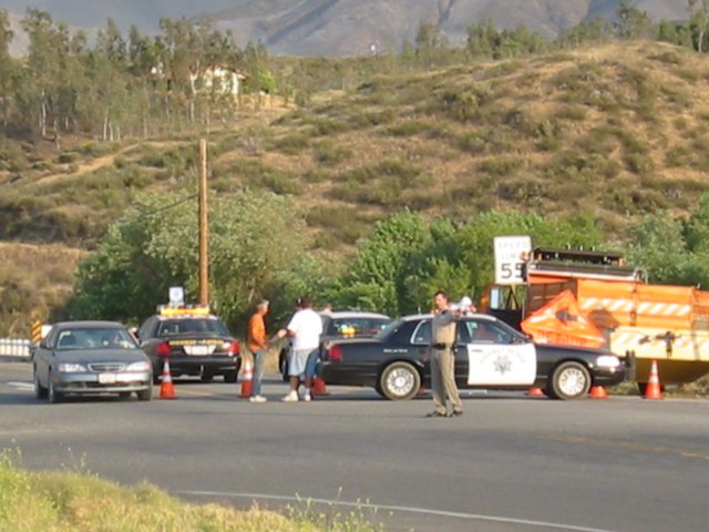
On Thursday morning, the fire's progress had been slowed considerably and smoke from the fire was not readily visible in the Temecula area. The current footprint of the fire was 8,945 acres burned, with 14 homes and 27 other structures destroyed. Fire containment was estimated at 80%, with full containment expected later Thursday and control on Friday. Evacuation orders had been lifted and traffic was being allowed the closed part of SR79 with California Highway Patrol escorts.
Friday saw the Eagle fire finally extinguished.
An emergency center for evacuees had been established Sunday at the Temecula Community Recreation Center. Hundred of people have been evacuated as of Tuesday morning. Mandatory evacuations have taken place in the Vail Lake area, near where the fire had jumped SR79.
High early spring temperatures combined with below average rainfall has made many areas in the region vulnerable to fires like the Eagle fire. This fire, combined with a fire near Aguanga (about 12 miles east of Temecula) a week ago point to a very early onset of the fire season this year. Other fires were burning Monday in the Inland Empire, including one near De Luz (parts of Fallbrook are also threatened), another near Lake Elsinore, and another up near Corona.
The pictures were contributed by Michael Mojarro, Judy Granito, Greg Turbeville, John Michaelson, Ann-Britt Murchison, Robert DeArmond, Dave Corrasa, Edward Hannigan, Jim Turner, Nancy Maisenbach and Robert Navarro.
The following video clips were contributed by Dave Corrasa, and depict the fire on Monday afternoon, May 3rd:
The City of Temecula is posting information on the Eagle Fire.
Read this Californian news article from Tuesday, May 4th. More fire information was available in Wednesday's articles, and in another story about the destroyed Dorland Mountain Art Colony.
See a list of all past weather happenings in the Temecula Valley over the past several years on the Features page. Browse a chronology of major Southwest Riverside County wildfires.
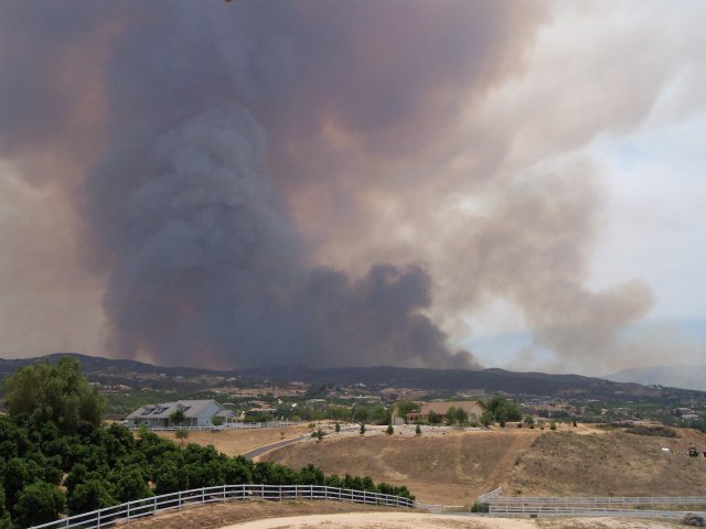
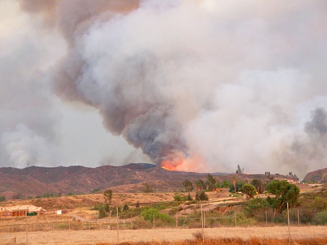
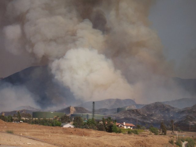
| The following photo was taken Tuesday at noon from the Glen Oaks hills area by Heather Storms. |
|
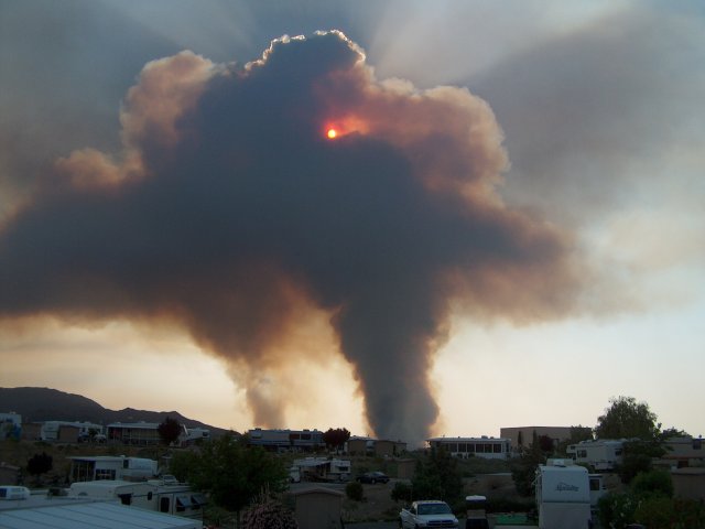
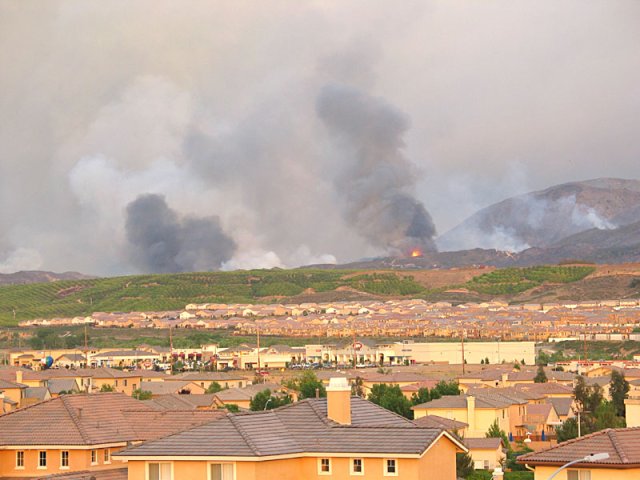
| The following photo was taken Tuesday evening from Aguanga by Nancy Maisenbach. In the foreground is the Jojoba Hills SKP RV Resort. |
|
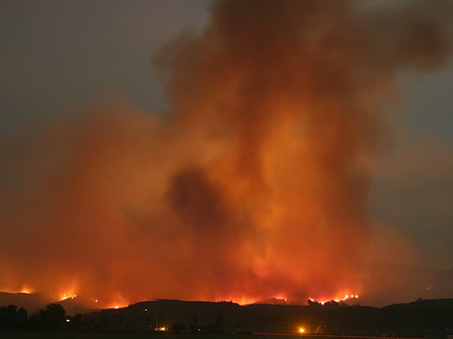
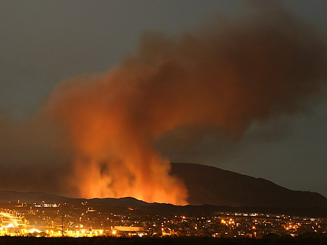
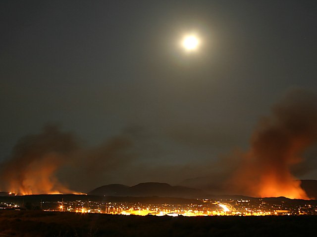
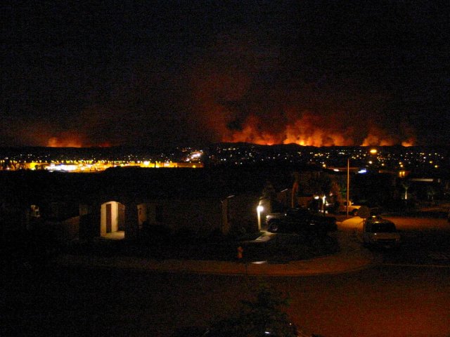
| The following photos were taken Monday night by Jim Turner: |
|
|
|
|
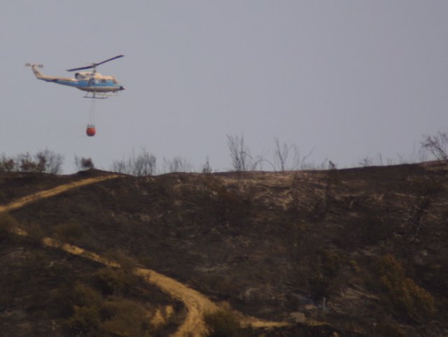
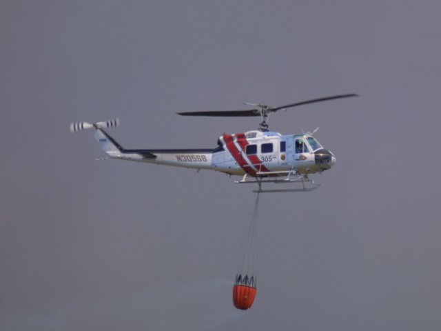
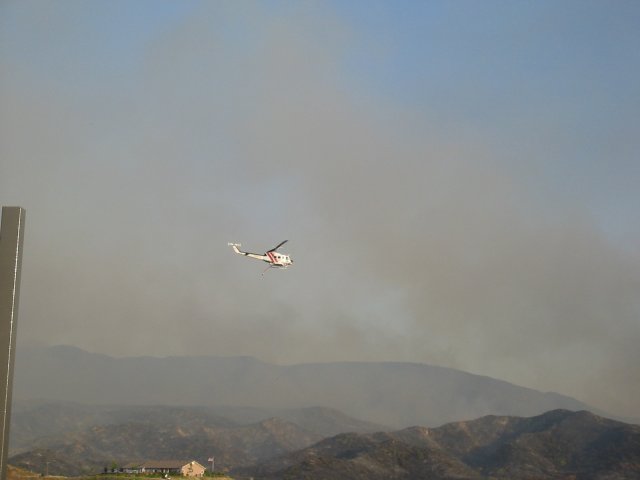
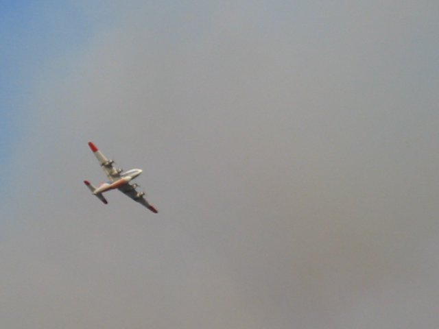
| The following photos of firefighting helicopters were taken Monday by Edward Hannigan. See additional photos at Ed's website. |
|
|
|
|
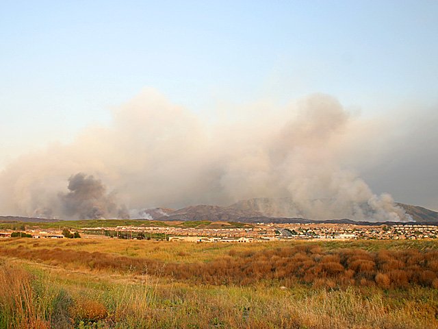
| The following photos were taken Monday evening by Robert Navarro: |
|
|
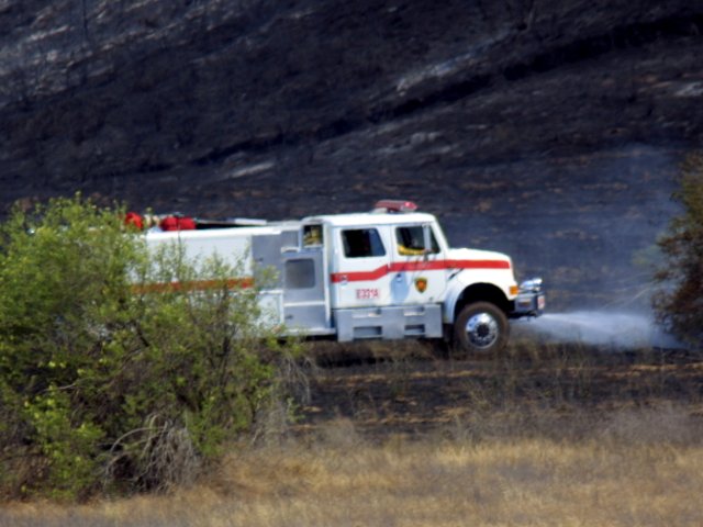
| The following photos were taken Monday evening by Dave Corrasa: |
|
|
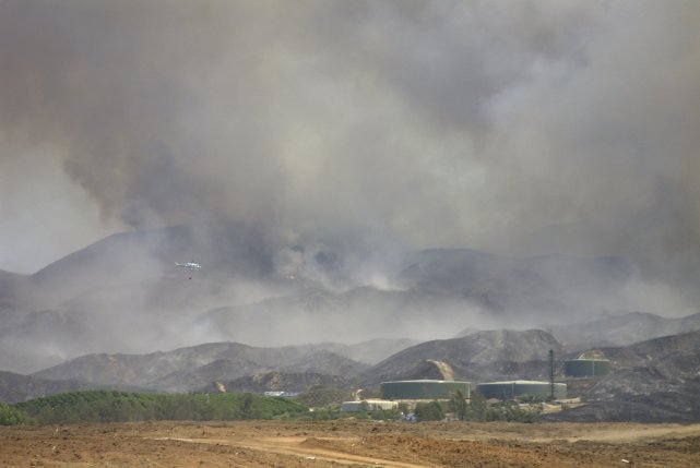
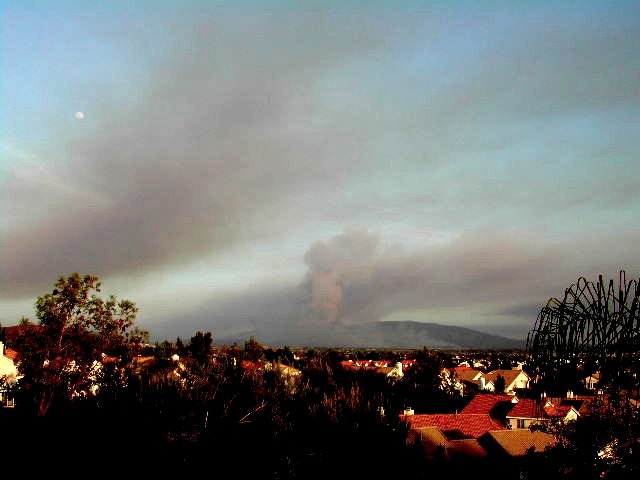
| The following photos were taken Monday evening by Michael Mojarro: |
|
|
|
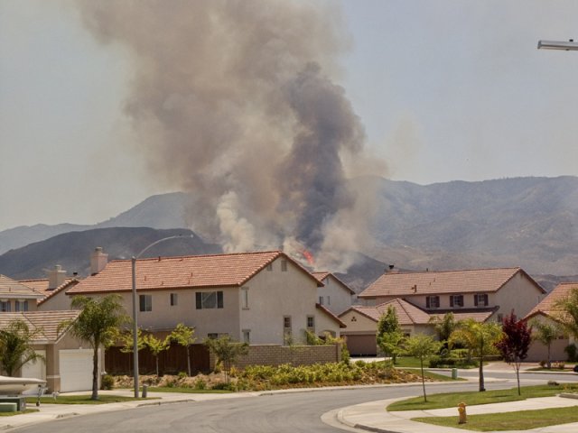
| The following photos were taken Monday afternoon by Ann-Britt Murchison: |
|
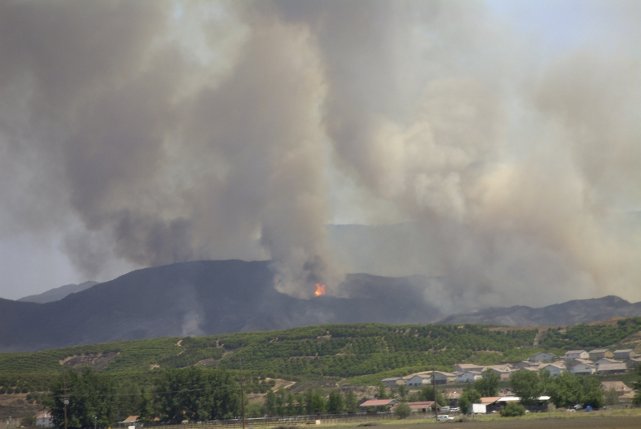
|
| The following photo was taken Monday afternoon by Robert DeArmond: |
|
| The following photos were taken Sunday evening in the 5:00 hour by Greg Turbeville: |
|
|
|
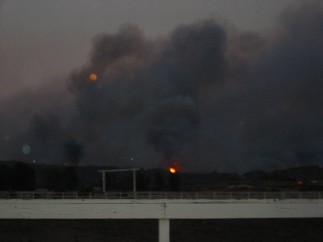
| The following photo was taken Sunday night by John Michaelson: |
|
| The following photos were taken Sunday afternoon and evening by Michael Mojorro: |
|
|
| The following photo was taken Sunday afternoon and evening from Murrieta by Judy Granito: |
|