Currently
N/A°F
in Temecula, California, USA

N/A°F / N/A°F
N/A
N/A
Monday, May 25, 2026 1:51 AM PDT
Temecula
Currently
Forecast
Past Weather
Climate
Last 36 Hours
Weather News
Features
About
F.A.Q.
Email Lists
Contact Us
Use °C/Metric
 RSS Feed
 Follow UsWeatherCurrents
Local Roundup
Mobile Access
On Your Site
Follow UsWeatherCurrents
Local Roundup
Mobile Access
On Your Site
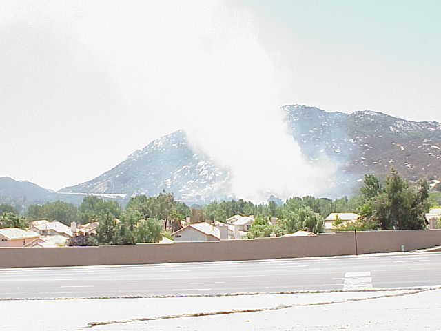
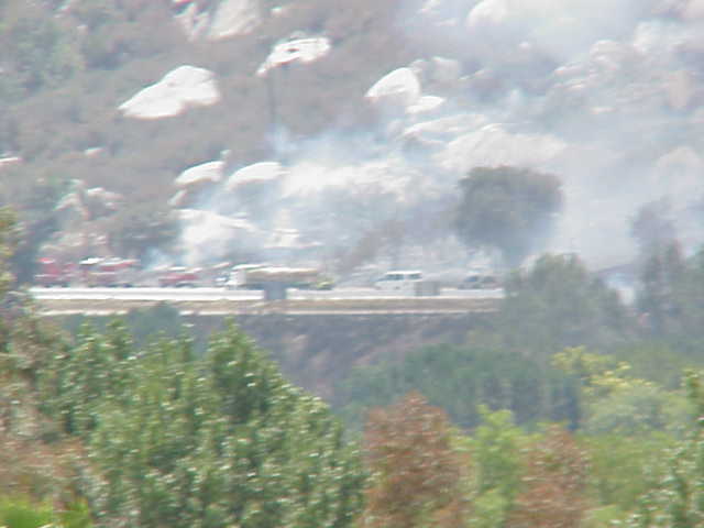
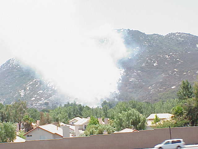
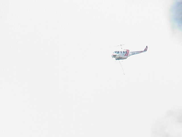
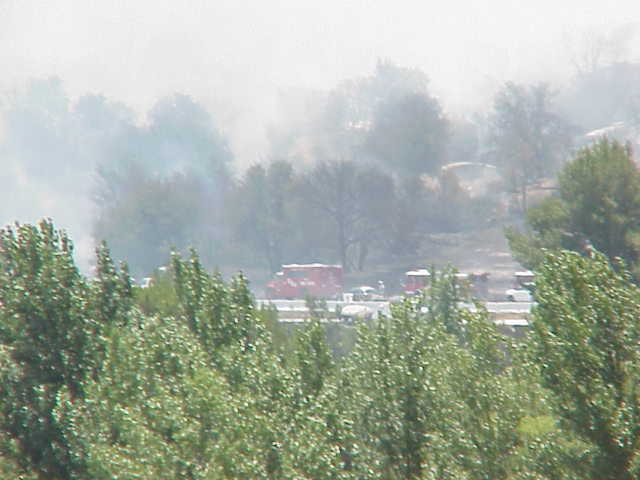
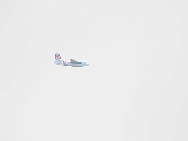
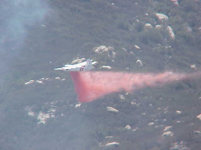
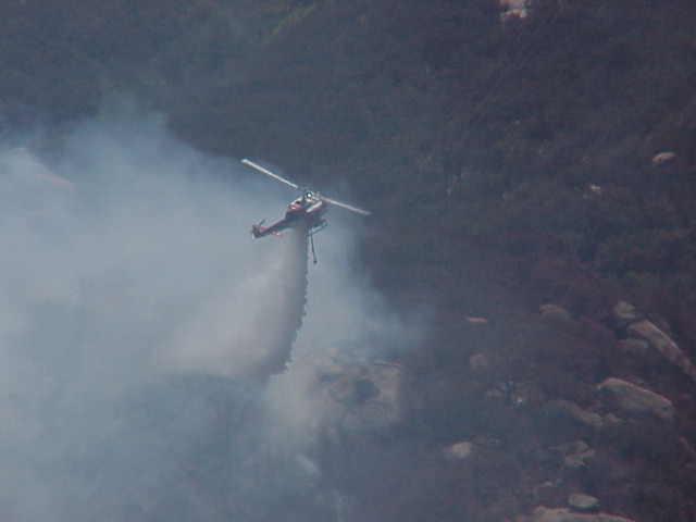
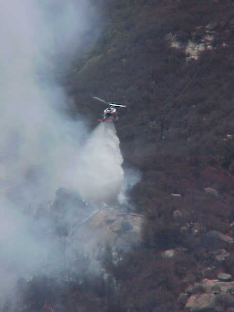
Photos From The Southbound I15 Fire: July 17, 2002
About 12:30pm on July 17th, a fire started in the granite hills where I15 rises out of the Temecula Valley, heading south into San Diego county. The fire was not large (10 acres burned), but the CDF brought out a fire bomber and multiple helicopters to fight it. The following pictures were taken near South Highway 79 and Pala Road by Sheldon Otto and capture some of the efforts against this fire. By his account, the helicopters were highly coordinated, scooping water from a pond at a local golf course.
You can read more about the fire in this Californian newspaper story.
See a list of all features, including fires, snow, hail and other events, on the features page. Browse a chronology of major Southwest Riverside County wildfires.
|
|
|
|
|
|
|
|
|