 RSS Feed
 Follow Us
Weather Sites
Local Roundup
Anza
De Luz
Fallbrook
French Valley
Hemet
Lake Elsinore
Moreno Valley
Murrieta
Pinon Hills
Riverside (Canyon Crest)
Riverside (Presidential Park)
San Diego (City Heights)
San Jacinto
Simi Valley
Temecula
Follow Us
Weather Sites
Local Roundup
Anza
De Luz
Fallbrook
French Valley
Hemet
Lake Elsinore
Moreno Valley
Murrieta
Pinon Hills
Riverside (Canyon Crest)
Riverside (Presidential Park)
San Diego (City Heights)
San Jacinto
Simi Valley
Temecula
Storm totals: July 11th-12th, 2012
By John C. Toman. Posted July 15, 2012, 1:08 PM.
The first monsoon storm of a just begun rain season led to rainfall amounts ranging from trace amounts to over a third of an inch in Southern California's inland valleys. Menifee recorded the most, with 0.41", followed by Beaumont's Cherry Valley (0.36"), Lake Elsinore (0.31") and San Bernardino (0.20"). Most of the rain fell overnight, from midnight into the early morning hours on Friday, although there were reports of raindrops Thursday afternoon and Friday afternoon as well. Thunderstorm activity got as close as the Santa Rosa Mountains and the Mohave Desert Saturday, and cumulonimbus clouds were still visible Sunday. Unlike the winter, summer tends to favor the eastern locations, as well as communities near mountain ranges, and along the Elsinore Convergence Zone. This storm favored mainly the northern areas, with only trace amounts of precipitation falling in much of Southwest Riverside County. The locations not measuring rainfall included: Temecula, Murrieta, San Diego's City Heights, Simi Valley, Fallbrook and De Luz. Here are the rain totals for the WeatherCurrents network and associates:
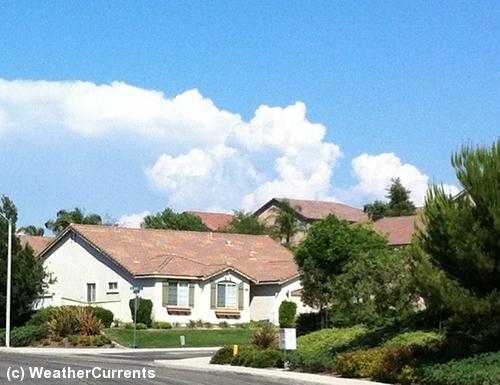
Thunderhead over the Santa Rosa Mountains. © WeatherCurrents - photo by Jim Purpura. |
Other Recent Weather News for WeatherCurrents
|